Eugowra station was established in 1834, and the town took its name from the station when a village popped up in the 1860s on the station about 35 kilometres east of Forbes.
The town is most famous for a gold robbery in 1862 when Frank Gardiner and his gang of bushrangers pulled off the biggest gold robbery at Escort Rock just outside of town. They held up an armed gold escort and stole 2,7219 ounces and £3,700 in cash. These days, it is known as the village of murals.
However, Eugowra should be famous for another regular natural feature – the persistent and repeating pattern of sudden large and damaging flood events.
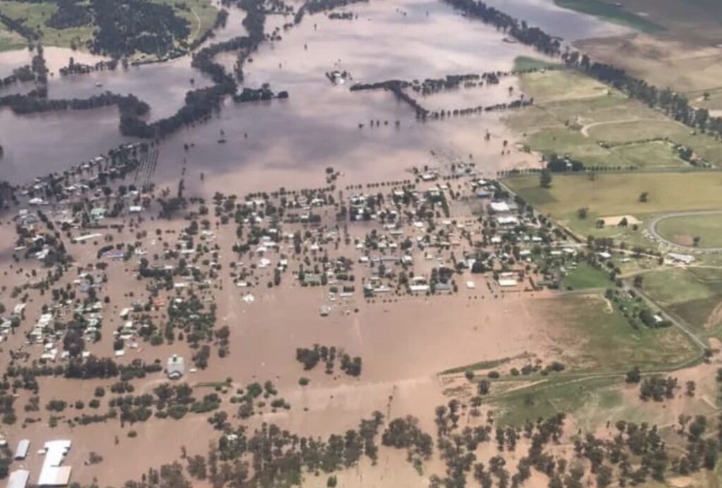
Two years ago, on 14 November 2022, a wall of water virtually swept the town away, nearly wiping Eugowra from the map. The residents were all but forgotten in the build-up to the event through rushed and late warnings. Immediately after the flood, the emergency response didn’t meet the expectations politicians kept promising after every emergency disaster.
The anatomy of the November 2022 flood
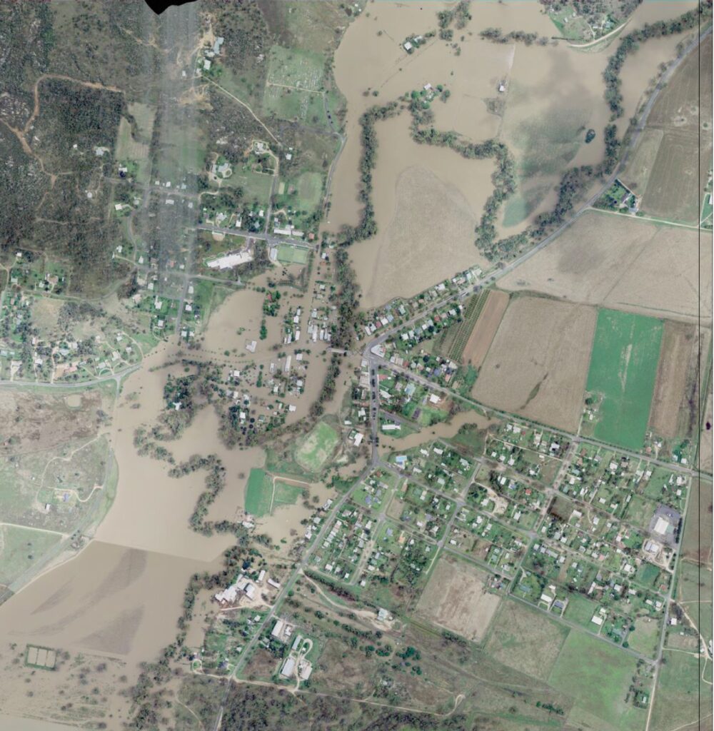
When residents were alerted to the flooding crisis about to envelope them in the early hours of Monday, 14 November 2022, Mandagery Creek was already just under 9 metres, with the western portion of the town under water.
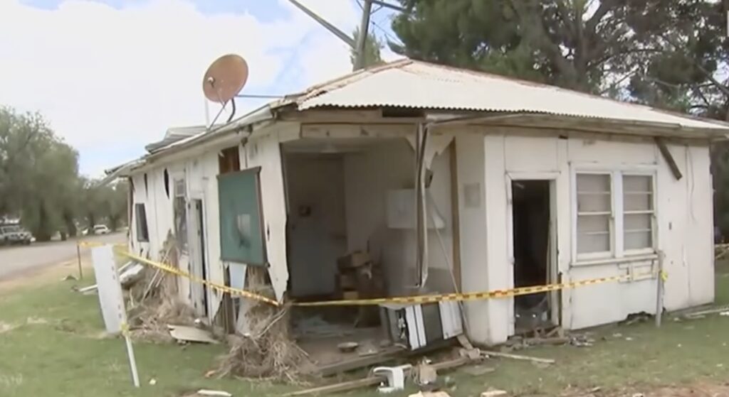
Over 80 per cent of homes and businesses were damaged. Some houses were torn from their foundations as the official peak hit 11.2 metres, surpassing the previous record of 10.97 metres in 1950.
By 6 am, farmers upstream were already in trouble as they encountered a great wall of surging floodwaters through their properties, stretching into paddocks, sheds and homes. The fast-moving water tore creek banks apart, uprooted trees and dragged anything in its path towards Eugowra, including water tanks, hay bales and livestock.
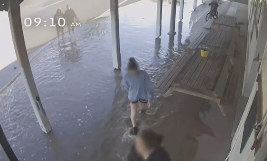
As helicopters began airlifting some farmers, CCTV footage from the pub at 9:10 am showed locals walking along the main street to look at the flood, oblivious to what was heading towards them. It had always been a local ritual to stand on the bridge and watch the western flood-prone side of the town get slowly inundated. Others in their homes prepared for work or dressed the kids for school.
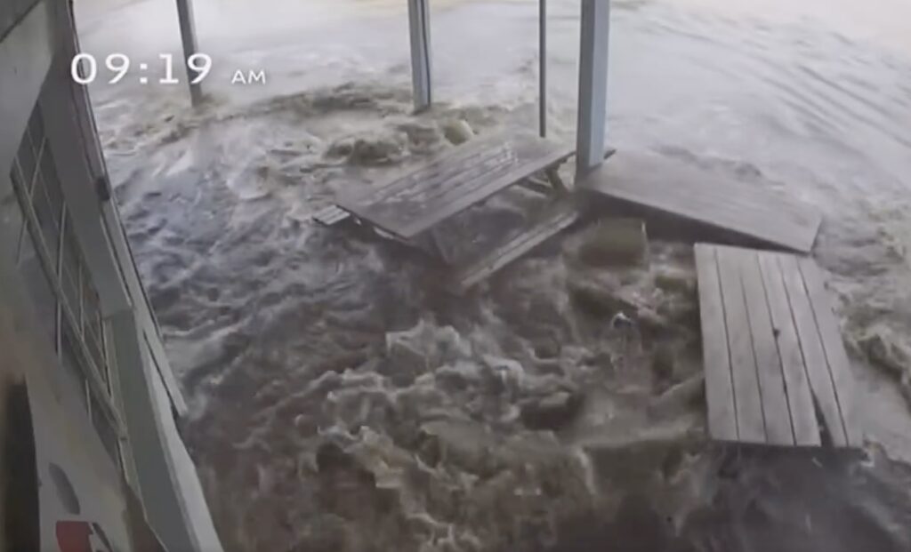
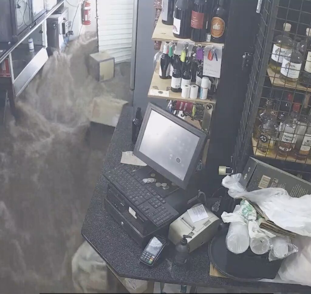
By 9:20 am, the waters in the town rose dramatically. One of the first to go was the pub, as its doors gave way to a powerful surge of water. Within ten minutes, water levels had risen a metre. Suddenly, the main street had become a river after a second surge of water hit the town.
People had to cling to whatever they could find. Some had to be rescued from their cars before swirling waters swept them away. Local café owner Judd McKenna rescued people in chest-high waters. Some managed to clamber onto their roofs and wait six harrowing hours for helicopters to airlift them.

Residents thought they were safe on the eastern side of Mandagery Creek – the “high side” of town where it is not supposed to flood. But like most significant events, memories get lost over time as that part of town has previously flooded. And after 9 am on 14 November, it flooded again.
Two people died, including Diane Smith, who was rescued, along with one of her sons, after waters inundated her house. The helicopter took them to the bridge, initially considered a safe place. Locals decided to shift to the emergency shelter at the showground. Diane drove herself to the showground. As she tried to avoid debris, the torrent swept the car off the road. She managed to get out of the vehicle and cling to a tree while talking to her sister on her mobile phone until it went dead. Authorities found her body two days later. The other person was 85-year-old Ljubisa “Les” Vugec, found by police in his home a few days later.
Past floods
According to Lance Pigeon, whose family lives in Eugowra:
“The history of old warning methods, large evacuations and heroic rescues show a repeating cycle of heroism and forgetfulness”.
The first recorded flood since European settlement occurred in 1858 when raging waters swept away sheep. A wild storm, hail and heavy rain in October 1863 blew the roof off the pub.
In June 1870, 19-year-old Tom Boney delivered a flood warning to Eugowra. He spent nine hours in the water, rescuing 13 people.
Locals constructed a boat to rescue an elderly couple in eastern Eugowra in February 1905 after a heavy storm unloaded lots of rain about two miles away, which flooded the eastern part of Eugowra, affecting several houses.
Many houses were inundated in October 1916, with walls washed away. A farmer’s house was swept away, and he spent a night on the roof of his shed. His rescuers rode four miles through the floodwaters to save him. Following the flood, the Cowra and Canowindra postmaster began warning Eugowra of “any heavy rains and threatened floods”. This system worked well until telephones took over and locals made assessments from the various river gauges upstream.
In August 1923, the Bedgerabong Football Club was fined when players could not travel to Eugowra through flood-blocked roads. A year later, flooding following what had become a familiar pattern – a concentration of water down the Canowindra Road affected most Newtown houses. The problem was accentuated by the failure of the railway yard viaduct to hold excess water.
In June 1925, residents in the part of town called Newtown were flooded again after seven inches of rain fell over a weekend. A large amount of water came over the racecourse and backed up against the railway before giving way, leading to the railway yards becoming a lake.
The April 1926 floods reached a height of 10.05 metres, affecting the lower eastern part of the town. After this flood, flood heights were measured by a height gauge placed on the bridge over the Mandagery Creek.
Old residents said the February 1928 floods were the first in 30 years since the Mandagery Creek overflowed, following localised heavy rainfall upstream around Manildra and Molong. Eugowra was the worst-hit town in the district. The creek rose four feet an hour, breaking the creek’s banks and flooding the “thickly populated portion of the town”. Afterwards, “five feet of additional water came down in one tidal wave”, washing cars and trucks away.
A flood event in June 1931 affected thousands of acres of newly sown wheat surrounding Eugowra after four inches of rain over the previous week. The western section of town flooded first, banked up through the streets, and then broke on the eastern side, splitting to flow around the highest portions. Then, it joined again, circling the town and isolating it.
Nearly four inches fell in two hours in February 1934. Flooding affected every house in Newtown, forcing rescuers to save many residents. Later that year, in November, waters from torrential rain in the Bumbaldry, Coates Creek and Manildra districts, combined with the flooding waters in the Cudal and Cargo districts, to produce a large flow of water which damaged Eugowra, particularly the southern end of town, creating new records. Authorities gave residents plenty of warnings, which allowed them to reach safety. Luckily, the Lachlan River was at low levels when allowing the water to flow away more easily without banking up too much in town, thus minimising the damage.
In August 1936, heavy rain led to minor flooding in a depression on the north side of Puzzle Creek flats that could not pass through the bridge. While Mandagery Creek didn’t break its banks, much flooding was downstream on the Lachlan River.
Mandagery Creek overflowed in June 1942 after two inches of rain, on top of two wet previous months.
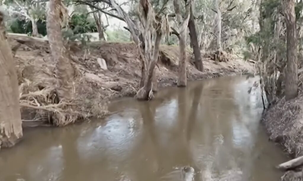
Eugowra experienced six flooding events in 1950, including three in a week in April. That week saw many rooftop rescues in one of the worst floods to hit Eugowra. Water levels reached 10.97 metres, exceeding the highest of 10.05 metres in 1926. Some people were complacent, thinking they were above flood levels, but were caught out. Some had to shelter on roofs overnight, awaiting rescue by boat the next morning. The flood reports were understated as Eugowra was a “dismal spectacle”, and very few buildings escaped damage, with water inside shops and houses reaching a depth of five feet.
Then, on Friday 4 August, Eugowra suffered another flood, with the Mandagery Creek reaching nearly 10 metres. Two months later, another flood reached 9.75 metres.
As with previous floods, the spirit of all helping each other out in time of need was very strong and signalled how important it was for everyone to cope with the threat of regular flooding. With no boats in town, the government called the army to help.
Flood waters isolated Eugowra in June 1952, resulting in a “light” flood. Because warnings were provided 24 hours earlier, residents and shopkeepers were well prepared, and aircraft supplied provisions. Another flood a month later saw a minor flood after water diversions failed to stop the flow of water from Canowindra Road and Puzzle Creek.
Similar minor floods over two successive days occurred in April 1959.
There were major floods again in February 1973, August 1990, February 1992 and November 2005. In December 2010, Eugowra flooded three times during the month.
A site prime for regular inundation
It is fair to say that Eugowra is poorly located and very susceptible to regular major flooding events.
It straddles both sides of Mandagery Creek at the connection with many tributary creeks and feeds into the Lachlan River that winds its way through the Central West region of New South Wales.
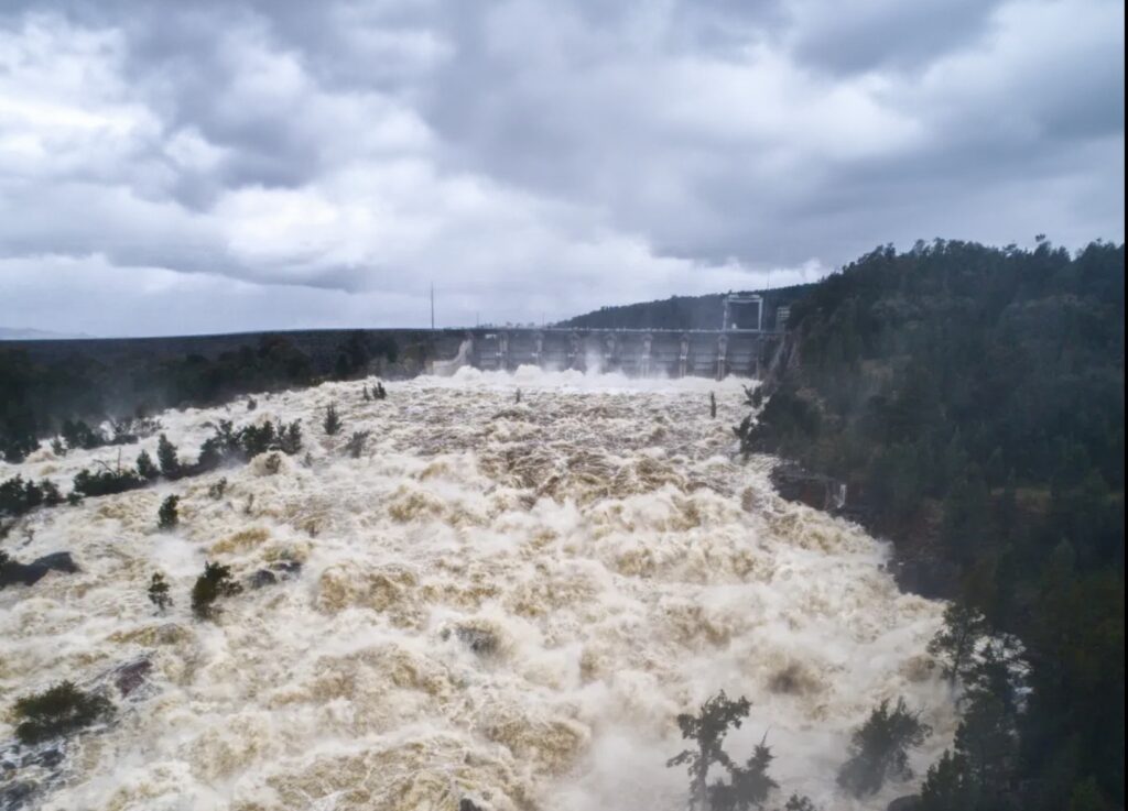
Mandagery Creek begins near Molong and meanders its 120 river miles to Eugowra. Along the way, it is joined by the fast-flowing Boree Creek and other tributaries. The flows from these two sub-catchments duplicate at Eugowra. Combined with high water levels downstream on the Lachlan River, fed by overspills from Wyangalah Dam, the swollen Mandagery Creek spills drastically at Eugowra.
After the severe 1950 flood, a major reflection on Eugowra’s flood risk revealed that authorities had done nothing to minimise risks from future flooding.
The eastern half of the town is located on the Puzzle Creek flats, which are prone to flooding. Consequently, many houses and businesses struggle to get flood insurance, limiting the town’s development beyond its current size of 876 residents. With a progressively ageing population, there is a risk that Eugowra will lose its services and gradually decline.
The government maintains the risk of major flooding damaging the town’s assets has improved with the Puzzle Creek flood levee work, even though it admits the current levee is ineffective. Forever and a day, there has been talk of improving flood works, but nothing has happened, apart from limited Council purchasing of the most flood-prone sites.
A detailed flood study was prepared in 1994 by the Department of Water Resources. It focused on a hydrologic model of the Mandagery Creek catchment upstream of the town. The report’s authors noted the difficulty in accurately predicting design discharges by their model due to uncertainty about the contribution of Waterhole Creek and Puzzle Flat Creek at peak flow and levels during the 1990 flood.
The 1999 Floodplain Risk Management study assessed a range of measures to reduce the flood risk at Eugowra. Its main findings focused on planning control of future development on the floodplain. It did include a voluntary purchase scheme to remove selected residential places in floodway areas and investigate a subsidised house-raising scheme.
After the 2005 flood event, the community raised several concerns about the accuracy of the modelling developed in 1994 and refined in the 1999 study. Government agencies did little except analyse the 2005 flood and recommend maintaining flood awareness in the community:
“… and continue support of the Flood Warning and emergency response procedures under the control of BOM and SES”.
The modellers love to include esoteric terms such as a 1 in 5,000-year flood event which simply refers to statistical probability based on a distribution of observed events over time. The tail end of any statistical distribution, especially one that measures the frequency of rare, extreme events is always the hardest to fill in. Simply put, the more extreme the event, the less data we have to make reliable predictions about how often it occurs.
So when bureaucrats, the sensationalist media, and even scientists declare that a particular weather event falls into a one in 5,000-year category, they do so with short periods of data collection, assumptions and modelling that is far from definitive.
Meteorological records only go back 100 to 150 years tops. That is far short of the 1,000 or 5,000 years needed to reliably estimate the occurrence of these so-called extreme events.
Even in the real world, it has been difficult to get comparable flood height data over the years as gauges have shifted from a wooden bridge to the creek bank. As history reveals, each flood varies in its inundation area mainly due to variable rainfall over the tributaries within the upper catchments.
Why did a wall of water hit Eugowra with little warning?
Today, with our sophisticated computers, technology and modelling, why wasn’t any flood monitoring intelligence sent to Eugowra in advance? How can a small town, used to flooding events over the years, get nearly swept away without little warning?
The government claims that on Monday, 14 November 2022, the flood event was so sudden and “unprecedented” that there was no luxury of time or a warning on the resident’s side. Yet, in the past, flood gauges upstream, when analysed by locals who knew the lay of the land, provided 10 to 12 hours of warning that water was heading towards them.
University of New South Wales hydrologist and former Bureau of Meteorology (BOM) employee, Associate Professor Fiona Johnson says:
“Ideally warnings come out a long time in advance, but when you have catchments where it only takes a few hours of really heavy rainfall, if that rainfall happens in the middle of the night, then the warnings do come out early in the morning, and that makes it really hard to communicate”.
Except, most of the rainfall occurred on the morning of Sunday, 13 November 2022, where the region upstream from Eugowra received a deluge with over 120 millimetres across the catchment. That should have immediately signalled a potential problem that needed to be closely monitored, not from SES headquarters in Wollongong, but by someone locally inspecting upstream catchments and talking to locals and receiving critical intelligence.
However, the New South Wales State Emergency Service (SES) only issued a “watch and act” over Eugowra on Sunday night as residents went to bed.
Later that night, BOM first began issuing warnings for intense heavy rain and potentially life-threatening flash flooding not for Eugowra but for most of “central New South Wales”. The first clue for locals was when BOM said, Mandagery Creek:
“Would likely exceed the minor flood level of 8 metres overnight and the major flood level of 9 metres on Monday morning, with further rises possible”.
The 10-metre wall of filthy brown water that was about to smash its way through the town was still unknown to the SES based in Wollongong. The local SES volunteers finally attempted to set off the town’s flood siren at 3:30 am on Monday. It did not work. They then drove through the streets with sirens blaring to wake residents on the flood-prone western side until the fire station’s alarm went off at 4 am.
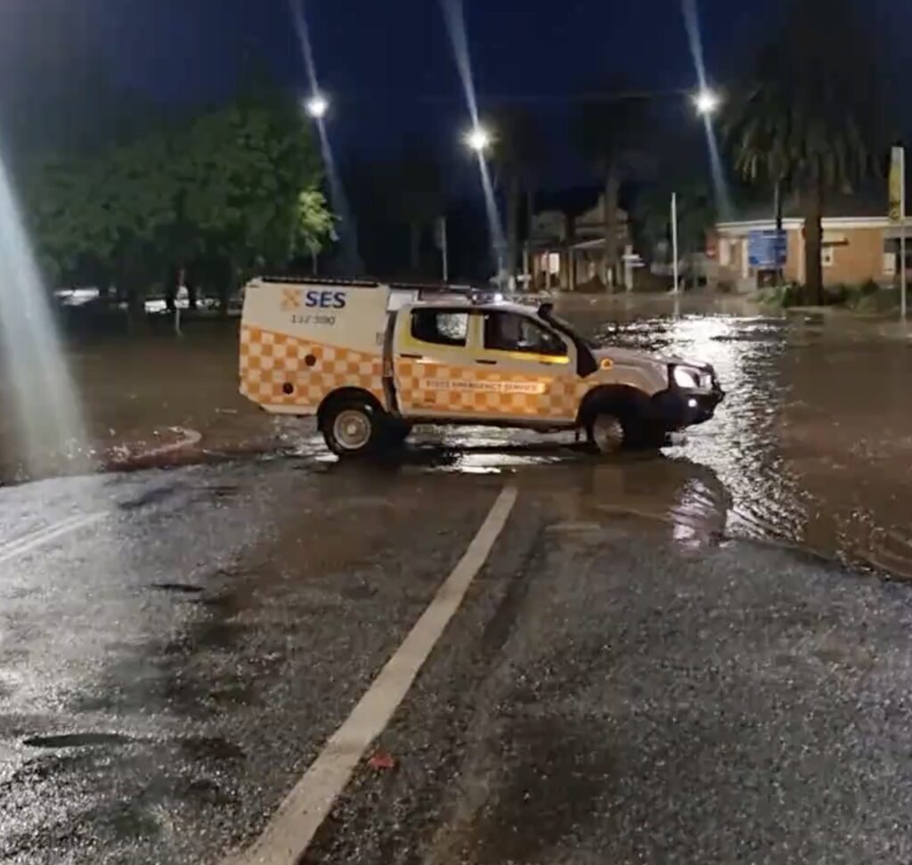
By 4:30 am, Mandagery Creek was just under the major flood level of 9 metres, and residents were still unaware of what was about to hit them. The western portion of the town was underwater, and authorities told residents to evacuate to the eastern side. However, that area has previously experienced flooding up to six times.
At 5:15 am, BOM cancelled its warning for intense rainfall as the weather system eased. However, for Eugowra, rainfall had already caused the damage the day before. At 5:56 am, SES finally upgraded the status of the situation to an emergency evacuation order. Perhaps they should have told residents flooding was already occurring, much like they did 14 minutes later:
“Flash flooding is occurring now in Eugowra, river levels continue to rise. People in low-lying areas need to evacuate immediately. Stay with family, friends or alternate accommodation away from flooding. Protect yourself and family. Listen to local radio, visit www.ses.nsw.gov.au or call 132 500”.
People reading the text were unconcerned as they understood it meant a regular flood, not a surging wave or wall of water.
BOM and SES were oblivious as BOM revised its warning again, saying Mandagery Creek might reach 10.5 metres that afternoon. However, flood levels reached record heights before BOM forecasted the peak. Farmers just 10 kilometres upstream were already in trouble, reporting massive flooding before 7 am.
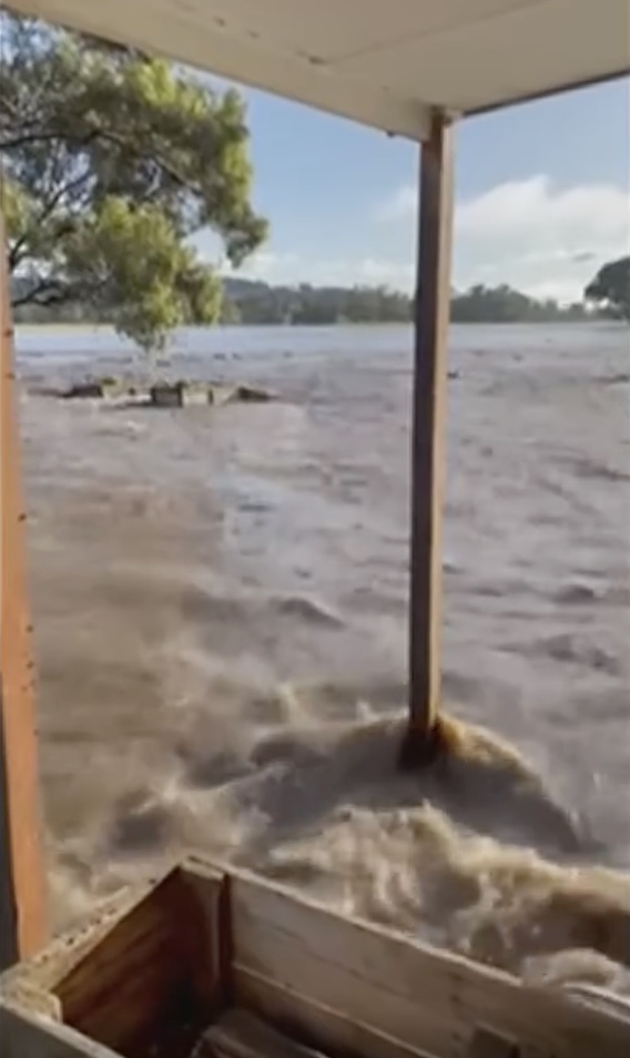
Around 9:30 am, power and phones went down. Raging waters washed away houses, and people sought refuge on roofs while awaiting evacuation. Resident and retired policeman Peter Jones was the first to ring 000 requesting helicopters to rescue people, but the operator told him it was not a major flood.
When reality finally dawned on SES headquarters, they deployed twelve helicopters to Eugowra and surrounding districts. They airlifted the first person at 10:15 am and rescued another 150 people, nearly 20 per cent of the town’s population. But it wasn’t until 10:21 am that SES upgraded their emergency warning to cover the whole town. That afternoon, BOM revised its predicted flood height to a major level of 10.3 metres.
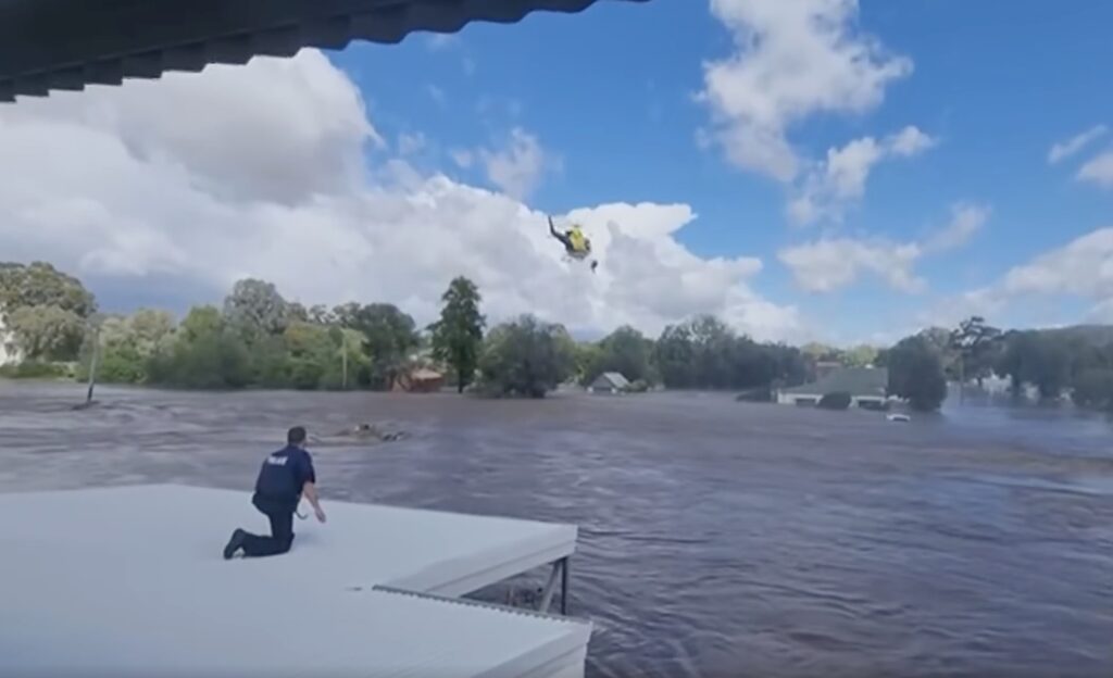
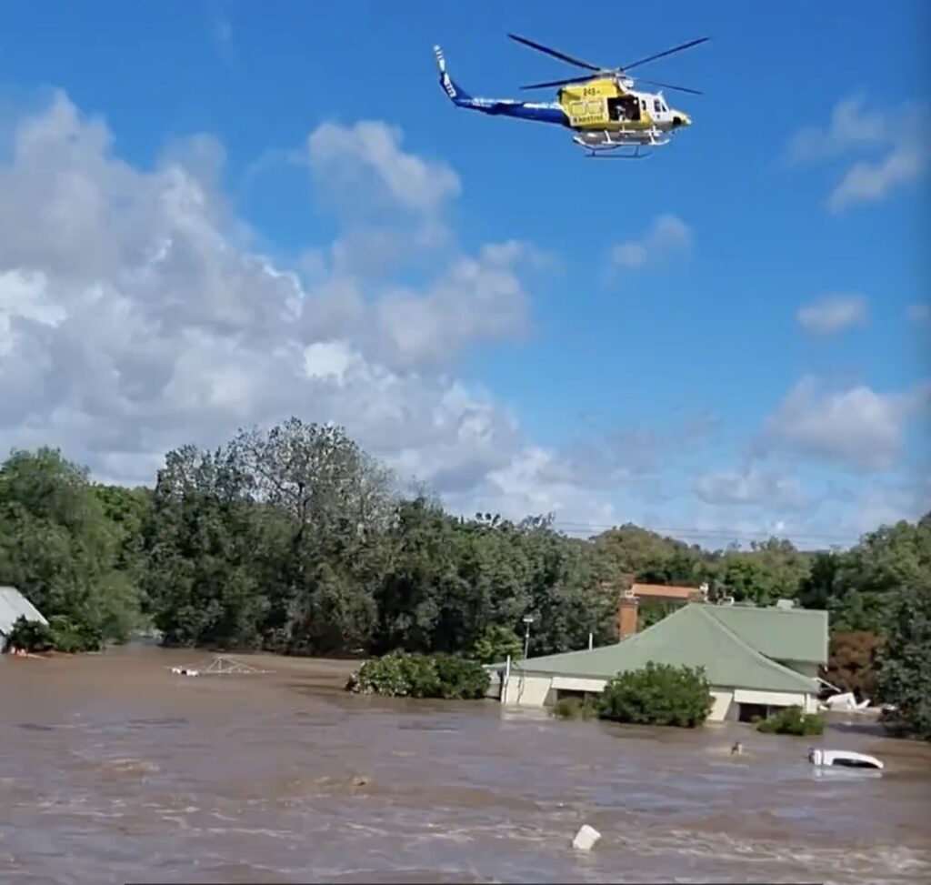
Clearly, BOM and SES struggled to understand the unfolding disaster. It is unsurprising as BOM’s National Operations Centre in Melbourne and SES’s Wollongong base issue the official decisions and directions.
Jones was scathing of the performance of poor response by SES. He confronted then-Premier Dominic Perrottet about a lack of emergency response when he toured the town on 18 November. Residents who made it to the showground found no one to tell them what would happen next. There was no food, no clothing, nothing.
Even more embarrassing for SES, they deployed 40 boats that arrived on Tuesday 15 November, after the flood waters had receded. SES staff and volunteers just stood around and watched another 20 boats arrive the next day.
Jones said the government and emergency services had enough time since the February floods to sort themselves out. “They’re slow learners”, he said. He argued that SES should have been able to immediately mobilise temporary medical facilities and staff, rescue facilities and personnel, power generation, temporary communication facilities, temporary accommodation, food and water, public toilets and showers.
Unfortunately, this is the pattern we see at all emergency events where local insight, knowledge and expertise are overridden by city-based bureaucratic inertia in offices far removed from the emergency.
Time to abrogate responsibility yet again
As I indicated in my story about the Richmond Valley floods in February 2022, once locally-based sufficient warnings disappeared, and they were no longer used to predict flood levels and timing, residents were put at more risk.
For Eugowra, there was no one locally monitoring the build-up of a significant flood event. Instead, bureaucrats sat in comfortable offices in Melbourne and Wollongong, staring at computers and models, oblivious to what was developing on the ground until it was too late.
SES told the media their response to the emergency was based on data, local knowledge and predictions from BOM. They said they issued nine warnings but said flash flooding can change with little notice and be difficult to predict.
According to Ray Augustin, a former Councillor in the 1990s, they were not adequately warned :
“We could have been told we would get an 11-metre flood at 10 o’clock [pm] on the 13th and we would have had all the residents out of East and West Eugowra… This should never have happened. We had no communications, no warnings”.
Simply put, emergency services are no longer appropriately attuned and equipped to accurately predict in advance an emergency at a more local scale that needs all the time available for preparation to assist the local population.
There are three stream gauges located at or near Eugowra that help with monitoring expected flooding.
Typically, the upstream gauges provided the people in Eugowra with around 10 to 12-hour warnings of what is heading towards them. However, Water NSW now manages the gauges, and they have admitted that they only exist now to provide information to government agencies for planning purposes and were:
“Not designed or intended for an instantaneous emergency management role in the event of flash flooding”.
It is a moot point anyway, as a Department of Industry map shows four other gauges above Eugowra that are either no longer working or a different agency manages them. The closest rain gauge sending real-time rainfall data back to BOM in the lead-up and during the flood is in Forbes, 50 kilometres downstream of Eugowra.
Eugowra’s rain gauge stopped recording any data on 1 November 2022. The closest working rain gauge is 17 kilometres north, but it only sends data to BOM once a day at 9 am, which does not raise a red flag if there is a sudden extreme burst of rain that runs into Mandagery Creek.
Data from river gauges is critical to build accurate flood models and monitor impending flood events. However, funding to maintain them dried up with the weather, and only after a flood hits, does it become clear how important they are. Having water agencies responsible for them is counterproductive as they don’t have any interest in monitoring flood events. Automation is too expensive for these agencies to contemplate.
The Independent Inquiry into the February 2022 New South Wales floods argued that a comprehensive, well-maintained gauge network had to be in place to allow authorities to predict more accurately what was unfolding and provide adequate warnings in advance, particularly for areas like Eugowra that are prone to flash flooding events.
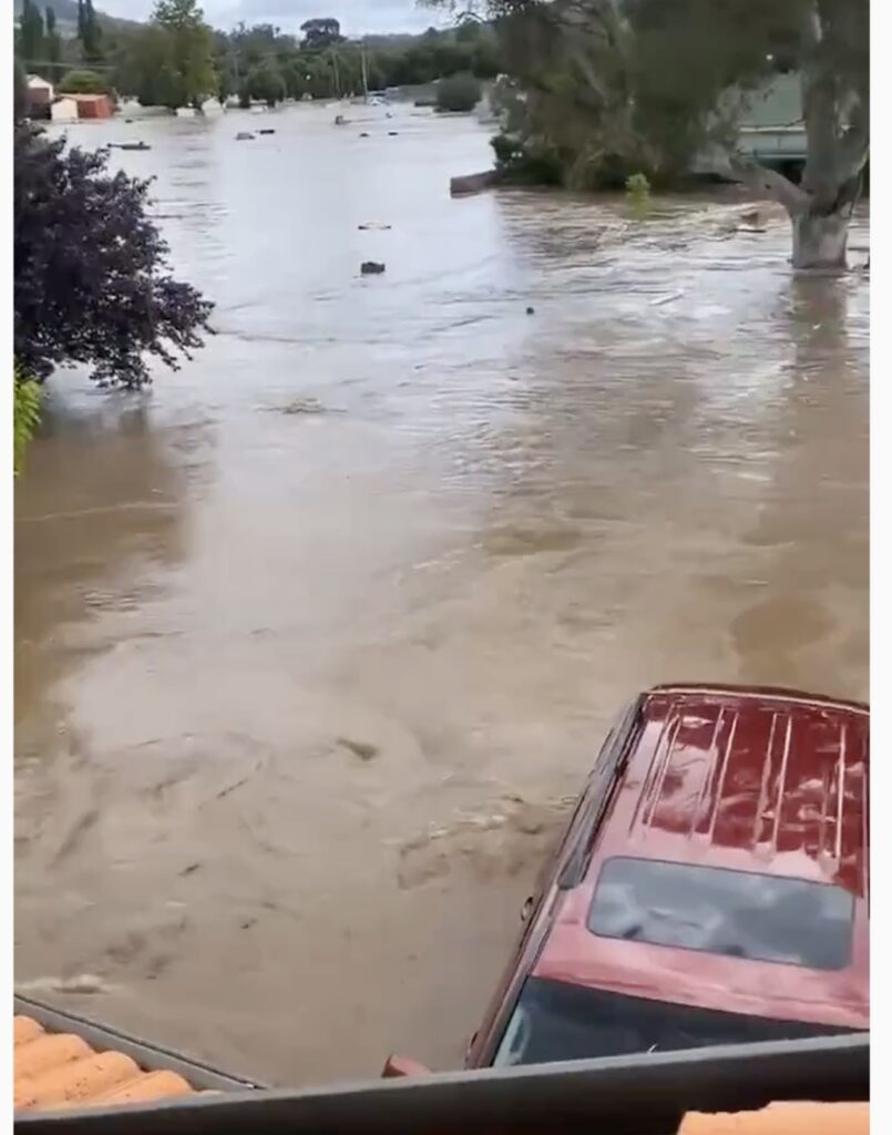
I spelt out this same problem for Lismore and how the ability of local officers who used these gauges was able to successfully estimate flooding heights and timing to give residents and businesses ample time to prepare for a flood event. They no longer do this as a centralised bureaucratic emergency response has taken over.
What I wrote in my Richmond Valley analysis is just as relevant nine months later:
“The floods received extensive news coverage, and politicians, senior bureaucrats and ‘experts’ were quick to label them unprecedented and something we could never prepare for and responding to them was a massive failure in government policy.
The way the 2022 NSW flood emergency panned out is no different to the problems we have experienced with bushfire emergencies in the last 20 years. The failure to prepare, the wrong information, advice and modelling relied upon, and the poor responses have all contributed to deaths and properties lost or damaged.
Governments, their agencies and the bureaucrats never admit they are wrong. They never admit to their failings. Their speeches, reports and documents are creative acts of sophistry. Bureaucrats are conditioned to report only one way – positively. Everything they do is a winner … there is zero reflection on what went wrong and what may give poor light on the government and its policies. This has led to a shambolic response to significant fire disasters in the last 20 years, which is no different from flood disasters … Unfortunately, accountability is non-existent when governments and bureaucrats are under the microscope.
The federal and state governments are adept at putting the focus of the disaster away from their inadequacies. This time, they have shifted the scrutiny onto the insurance industry by holding an inquiry into the insurers’ responses to major flood claims.
While it is convenient to bash the insurance industry, insurance is based on risk. It is important to note that many residents are uninsured as premiums grew to $40,000 a year due to the high flood risk with the town in a designated floodplain. Understandably, the insurance industry does not want to accept the risk of large and regular payouts for a town like Eugowra.
Concluding remarks
I waded through the government’s investigation of the November 2022 flood behaviour. It places a heavy reliance on the engineering pitfalls and problems trying to model and predict flooding and trying to quantify the frequency of floods in terms of their “Annual Exceedance Probability”, but nowhere is there any discussion about how to prepare the town for an imminent flood, how and when someone or some organisation would be responsible for monitoring rainfall and water flow in the catchments to predict flooding height, how an orderly evacuation would occur etc etc.
Hydrologists question whether accurate flood predictions are made that the community needs. It is believed that official rain gauges around Eugowra didn’t capture the rainfall in other parts of the catchment, which was much higher. At the headwaters of Boree Creek, Lidster had 203 millimetres of rain on Sunday 13 November. At official stations, Manildra recorded 178 millimetres and Cargo 152 millimetres, much more than BOM’s official statement that 120 millimetres fell in the catchment.
BOM claims its National Centre for Extreme Weather plays a vital role in responding to extreme weather events under a $58 million support package. It is supposed to accelerate the deployment of specialist prediction models, including a new national flood forecasting system.
It is becoming abundantly evident however, based on flooding in other areas earlier in the year, that BOM cannot predict at a localised level with precision the expected flood height and when it will occur, despite receiving millions of taxpayers funds to do so. All this work was successfully done in the past by local monitoring without the need for sophisticated computers and models. Oh for the return to the good old days when local emergency support staff had a good appreciation of the local scene.
For all its pretence at accurately providing weather predictions, the computer modelling used by BOM predicted heavy rain for the Southern Tablelands on Sunday 13 November, not the Central West region, including Eugowra. While predicting weather events can be hit and miss, perhaps BOM should spend more of its annual $1 billion on powerful computer modelling to better predict these rain events instead of trying to scare the population with predictions of climate armageddon by fudging the temperature figures.
Rather than staring at a computer model in a city far removed from the action and trying to make sense of a complex situation, having more localised people with a thorough knowledge of their area who can be further trained to monitor the development of rain events and use properly maintained and functioning rain gauge meters would place them in a much better position to forewarn residents and businesses.
For any location, the flood pattern can depend on a sudden cloud burst over a particular area and so the agility of a locally placed source who could be mobilised straight away is crucial.
How many more major flooding events will it take before the penny drops?
Great research Robert. Reflects exactly what we went through in 2021 on the Manning River Taree. We have several river height guages in our catchment which give up to 12 hr warnings of such walls of water. Luckily we looked ourselves at the gauge heights and compared historic heights of various guages under previous events of the last 100yrs and prepared ourselves and others early. It’s as simple as looking at past events, comparing heights and making a few bush judgements around tides and various effects of different feeder catchments and maybe a phone call or 2 to some locals upstream. Not rocket science. Our major flood warning and evacuation order came after the water was already here and we had luckily already prepared and bunkered down. I feel for others that weren’t so lucky and those that will be let down by incapable disaster management agencies in the future
I suggest that if people are interested in this complex, emotive and highly political topic of people and flooding, that they read below:
A RIVER WITH A CITY PROBLEM: A HISTORY OF BRISBANE FLOODS by Margaret Cook.
A well thought out article Robert.
The failures of centralised approaches are on display, as well as communication, warning, emergency, evacuation, use of gauge flood height estimation, use of local expertise, learning and accountability failures and concerns.
As we both know, the same issue applies across bushfire disasters.
Increased flood and bushfire mitigation is needed as previously identified by the federal productivity commission. Current limited disaster ready funding won’t work when there is very limited mitigation efforts and focus for all Australian disaster areas, including flood and bushfire mitigation.
Robert,
Unfortunately, again you are preaching to the converted.
Once again we see where the introduction of “Incident Management Systems” has the management and operational response directed from remote high tech “control centres” staffed by non operational personnel.
Numerous screens showing a plethora of information and imagery. These screens perform the role of the political “noddies” often seen behind politicians when making pronouncements in the media! This after the event process does nothing to address the immediate identification and response required at the local level.
The introduction of the IMS has stealthily and deliberately removed the capacity for local immediate decision making.
Notwithstanding that many historically flood/bushfire prone communities have short term memories of events that have been experienced on a regular basis. That, and the reduction in community resilience as a result of changing demographics, and a misplaced belief that emergency response agencies (read volunteers) have the resources and capacity to respond and manage the total impacts on people and property! The mantra for these communities is “any response will be limited and will be concentrated on the greater good for the greatest number!!!
Planning and preparation is more effective and efficient, albeit not as sexy as response machinery. Water bombing aircraft spring to mind.
Bernard, quite the contrary. I am not writing for the converted but instead to help future generations understand the stupidity by leaving a paper trail.
Robert,
I am in no way deriding your commentary. The last 40 years indicate that past occurrences have not been used to improve preparedness /response by communities and government.
I understand where you’re coming from, Bernard.
I like to convince myself that, even if only the converted read my blogs, at least there’s a record out there — something to say ‘we told you so’ when (hopefully) common sense returns. It’s important for future generations to know that many of us, without the voice or ear of the mainstream media, saw through the nonsense and called out the incompetence and folly. That way, we won’t all be painted with the same brush when the reckoning comes.
“The only thing that we learn from history is that we learn nothing from history.” German philosopher Georg Hegel.